Descent from Les Orres via the County Town.
At the start of the route, you can admire the lake from the heights of Les Orres. Once the descent begins, the landscape passes too quickly to pay much attention, but the nature of the terrain changes. The winding, root-clogged paths winding between the larches give way to dry, stone-paved paths in the heart of the pine forest, then narrow paths that disappear under the leaves of downy oaks lead you to the banks of the Durance.
.3 points of interest
 Pastoralism
The pastre
This is the Provençal word for shepherd. The trail got its name because of its many traces of pastoral activity along the way. Among other things, you can see the remains of ancient shelters known as muandes. These were used as stopovers between the farm and the mountain pastures during the transhumance up to the summer pastures at the start of the summer and during the transhumance to lower pastures in the autumn.
. Vernacular heritage
church of Saint-Sauveur
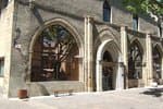
The church of Saint-Sauveur, also known as the Church of the Transfiguration, was built in the second half of the 15th century. It is easy to identify by its bell tower, which rises high above the town of Embrun and Lake Serre-Ponçon. The interior of the church is particularly notable for its restored murals. They mainly depict the Transfiguration, the period in Christ's life when he revealed his divine nature to his disciples so that they could recognise him as the Messiah. History
Footbridge over the Durance
This footbridge, which was completed in 2019, links Embrun with Crots and Baratier. Although it is a recent development, it actually boasts a long history. It stands on the exact site of the temporary bridge that replaced the La Clapière road bridge from 1953 onwards, which was destroyed during the Second World War by resistance fighters from the Embrunais area after the failure of an American bombing to do so. The aim was to prevent German forces from sending reinforcements to Gap, whose liberation was imminent. Although the bridge managed to withstand the American bombs, several people were killed and an explanatory panel on the footbridge pays tribute to them today.
.
Description
- Ascend the small road through the village from the church car park. At the first intersection after the fountain, turn right, staying on a small tarmac road. Follow the road towards Le Méale and Crévoux. The route continues along a track past a farm at the heights of the village. Follow the trail on a moderate slope overlooking Lake Serre-Ponçon. After a few hundred metres, the track enters a larch forest. The slope then steepens and becomes even steeper over a short stretch of concrete. After a hundred metres or so, the track is once more made of dirt and twists through the larch grove.
- 2.8 km from the start, the route passes through a car park in the woods, always taking the track over increasingly flat ground. The descent begins a few hundred metres after the car park. Don't miss the junction 50 m after the start of the descent at the sign for Les Graves sign. Turn left onto a single track and then right after 15m, staying on the single track. Join a wider path on the right and immediately turn left to pick up the trail once more. It then winds through the forest and emerges on a wider path at the end of the forest. Turn left and descend this path until you enter the forest once more. Immediately turn left onto a narrow path that soon leads back to a wide, stony track downhill.
- At the first hamlet of Saint-Sauveur, you return to the road. Take a footpath to the left at the first junction and follow the road downhill. Leave the hamlet and take the path on the right at the first bend. Turn left at the crossroads in the middle of the fields, staying on a wide path. After a few hundred metres, the path descends back to the road. Turn right through the village of Saint-Sauveur, then pass behind the church. A narrow path leaves the church car park and joins the road. Descend the road for 200 m and take a wide path on the left. Go straight ahead at the first junction, then right through the pines and right again on a narrower path 30 m further on. Head right after returning to a wider path, then left. Veer left again on a single track in the pine forest. Follow the track through the forest. After a long section of single track, turn left onto a wider path on a flat area. Cross the river and turn right just after onto the single track. Continue straight ahead on a wider path.
- The path ends on a road. Turn right then left onto the departmental road. When you reach the main road, turn left and continue along this road. When you reach the Orres road, follow it down towards Embrun. At the roundabout, take the first exit and continue straight ahead. Then cross the cattle drive to reach the Entraigues shopping area. At the roundabout, go straight on towards the Durance to rejoin the path you took on the outward journey.
- Departure : Les Orres County Town.
- Arrival : Lake Embrun
- Towns crossed : Les Orres, Saint-Sauveur, Embrun, and Baratier
Altimetric profile
Information desks
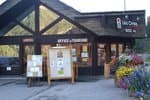
Tourist office Embrun
Place Général Dosse - BP 49, 05202 Embrun
October to march : Monday to Saturday, 9.00 - 12.30 & 13.30 - 17.00.
April, may, june & september : Monday to Saturday, 9.00 - 12.30 & 14.30 - 18.00
July and August : Monday to Saturday, 9.00 - 19.00. Sundays, 10.00 - 12.30 & 16.00 - 19.00
On French national holidays (except 14th of July and 15th of August) : 9am to 1pm. Closed on the 1st of January, 1st of May, 25th December and 11th November
Closed on Thursdays outside French holidays’ periods
Access and parking
Follow the N94 from Gap or Embrun, then the D40 as far as Embrun to reach Les Orres. Finally, follow the signs for the "Chef-lieu”.
.Parking :
More information
Source

Report a problem or an error
If you have found an error on this page or if you have noticed any problems during your hike, please report them to us here:

