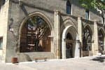
The balconies of Saint-André d'Embrun
2 points of interest
 Water
WaterThe Durance
The Durance is the most important river in Provence and the third largest tributary of the Rhône, behind the Saône and the Isère. It rises in the Hautes-Alpes in the municipality of Montgenèvre and is soon joined by the Clarée and Guisane rivers, which flow past it despite being longer and having a greater flow at the confluence point. The Durance valley has been a major communication route for centuries, and its capricious nature has been controlled by the artificial lake at Serre-Ponçon and a canal running downstream. The old proverb from the Ancien Régime, which once claimed that "the three scourges of Provence are the Mistral, the Durance and Parliament", has now been forgotten, and the Durance now brings nothing but life to the land it irrigates.
. History
Footbridge over the Durance
This footbridge, which was completed in 2019, links Embrun with Crots and Baratier. Although it is a recent development, it actually boasts a long history. It stands on the exact site of the temporary bridge that replaced the La Clapière road bridge from 1953 onwards, which was destroyed during the Second World War by resistance fighters from the Embrunais area after the failure of an American bombing to do so. The aim was to prevent German forces from sending reinforcements to Gap, whose liberation was imminent. Although the bridge managed to withstand the American bombs, several people were killed and an explanatory panel on the footbridge pays tribute to them today.
.
Description
- From the church, take the road downhill to join the D994d. Then turn left towards Embrun. Drive for 4 km and, at the STOP sign, turn right and cross the Durance on a metal bridge (wooden floor) towards Embrun. Quickly, turn left and follow the route de la Digue, which is closed to vehicles.
- The road runs alongside the river and provides a view of Embrun's citadel. Reach a footbridge and cross back over the Durance. Follow the cycle path towards Baratier (short section under the N94) and head towards a roundabout.
- Take the third exit towards Les Orres (D40) and climb for 4km before reaching a fork. Now turn left onto the D39a towards Saint-Sauveur. You'll be rewarded with some beautiful views of the lake as you pedal along. Once in Saint-Sauveur, make a short stop to admire the breathtaking panorama.
- Continue on this balcony road for 4 km, joining the D39 at a hairpin bend. Turn left towards Saint-André-d'Embrun to return to the starting point.
- Departure : Saint-André-d'Embrun
- Arrival : Saint-André-d'Embrun
- Towns crossed : Saint-André-d'Embrun, Saint-Sauveur, Embrun, and Baratier
Altimetric profile
Information desks
Tourist office Embrun
Place Général Dosse - BP 49, 05202 Embrun
October to march : Monday to Saturday, 9.00 - 12.30 & 13.30 - 17.00.
April, may, june & september : Monday to Saturday, 9.00 - 12.30 & 14.30 - 18.00
July and August : Monday to Saturday, 9.00 - 19.00. Sundays, 10.00 - 12.30 & 16.00 - 19.00
On French national holidays (except 14th of July and 15th of August) : 9am to 1pm. Closed on the 1st of January, 1st of May, 25th December and 11th November
Closed on Thursdays outside French holidays’ periods
Transport
- Zou! Network : Line 69 / Frequency : Every 4 hours
More information: https://zou.maregionsud.fr
Access and parking
Parking :
More information
Source

Report a problem or an error
If you have found an error on this page or if you have noticed any problems during your hike, please report them to us here:
