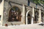
Loop 55 - Lac du Siguret
2 points of interest
 History
Vintage swather rake
This vintage farm implement was horse-drawn. The farmer sat on the iron seat. Its teeth form a kind of rake and its purpose was to pile up the hay in rows (known as windrows).
 Flora
FloraArable weeds
Arable weeds are unique in that they live in fields without actually having been sown there. They are biologically suited to open environments and especially to regularly worked areas such as fields. They use various strategies, such as adapting their biological cycle and producing large quantities of seeds to make up for disturbances in their growing zone. Many of them are well-known, such as the poppy, cornflower and buttercup...
Description
- At the school in Saint-André d'Embrun, turn right at the washhouse and go up the Chemin de Clotinard. At the road, turn right and then left onto the forest road (DFCI track H33).
- On the straight stretch, descend the path on the left and at the crow's feet intersection, take the ascend on the left. Follow a discreet path opposite and continue straight ahead (/!\ wetland and stones).
- At the water tank, descend to the right. At the bend, turn right up the road and continue straight ahead on the track to reach Lac de Siguret.
- At the lake, turn left twice and then right to reach a crossroads of 4 paths: continue straight down the stony path /!\. Continue left along the edge of the field and forest.
- Take the slightly uphill road to the left. (D994D).
- At the entrance to the village of Siguret, descend once to the right and again at the fountain to join a path.
- At the end of the path, turn right then left up a small road.
- At the road (D994D), turn right to cross the hamlet of "La Place". Stay on this road.
- At the D139, turn left twice in the direction of the county town until you reach the arrival point.
- Departure : Saint-André-d'Embrun
- Arrival : Saint-André-d'Embrun
- Towns crossed : Saint-André-d'Embrun
Altimetric profile
Recommandations
 In mountain pastures, protection dogs are there to protect the herds from predators (wolves, etc.).
When I hike I adapt my behavior by going around the herd and pausing for the dog to identify me.
Find out more about the actions to adopt with the article "Protection dogs: a context and actions to adopt".
Tell us about your meeting by answering this survey.
Information desks
Tourist office Embrun
Place Général Dosse - BP 49, 05202 Embrun
October to march : Monday to Saturday, 9.00 - 12.30 & 13.30 - 17.00.
April, may, june & september : Monday to Saturday, 9.00 - 12.30 & 14.30 - 18.00
July and August : Monday to Saturday, 9.00 - 19.00. Sundays, 10.00 - 12.30 & 16.00 - 19.00
On French national holidays (except 14th of July and 15th of August) : 9am to 1pm. Closed on the 1st of January, 1st of May, 25th December and 11th November
Closed on Thursdays outside French holidays’ periods
Transport
Bus : Valserres, La Bâtie Neuve, Chorges, Puy Saint Eusèbe, Puy Sanières, Embrun Baratier, Les Orres, Remollon, Theus, Espinasse
Marseille-Briançon : (LER29)
Marseille, Nice : Lignes Express Régionales (LER) +33 (0)809 400 415
Grenoble : Transisère +33 (0)4 26 16 38 38
Gap-Barcelonnette (LER535)
Carpooling area : Rond point des Orres - 05200 Baratier
Plane:
Marseille Provence Airport (188km) - +33 (0)820 811 414
Grenoble Alpes Isère Airport (158km) - +33 (0)4 76 65 48 48
Lyon Saint Exupéry Airport - (203km) +33 (0)826 800 826
Turin Caselle Airport - (178km) + 39 011 567 63 74
Access and parking
Parking :
More information
Source

Report a problem or an error
If you have found an error on this page or if you have noticed any problems during your hike, please report them to us here:
