Loop 58 - Tour of Crévoux
2 points of interest
 History
Crévoux
Nestled amongst peaks approaching 3,000m, such as the Grand Parpaillon and Pic Saint André, the village of Crévoux occupies a deep valley that has seen the establishment of several hamlets, including La Chalp, which extends over a narrow alluvial terrace. Once at the heart of a major craft industry, with the rise of basket-making and cabinet-making, the village now revolves around its small ski resort, created in 1937, making it one of the oldest in the Hautes-Alpes. History
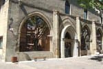
Cabane des Espagnols
This hut is a memorial to the Spanish refugees who were mobilised in Crévoux to maintain and repair the Parpaillon road, a militarily important road in those troubled times. The Spanish camp at Crévoux was set up in 1939, on the eve of the Second World War and in the twilight of the Spanish Civil War, which saw Franco's victory and the flight of many Spanish republicans to France.
Description
- From the village square, take the street leading from the war memorial. At "Champ La font 2", climb the gravel track towards the hamlet of La Chalp. Continue straight ahead on the main road. At Travers du Moulin go straight up the track.
- At the bend continue straight ahead (stony ascent). At the bend in the road (D39T), turn right.
- At the picnic area, take two right turns. Stay on the main hairpin path.
- Take the descent, and turn right at the bend of a track. At the crossroads, continue straight ahead (quick return possible on the right along the blue route 57)
- At the crossroads of the DFCI track H24, descend to the right. At Faravelle continue straight downhill then turn right. At the junction (at the end of the flat track), turn right and stay on the main track.
- At Les Gaillards, turn right down the road towards Saint-Sauveur. At the church of Saint-Sauveur, turn right onto the road.
- Turn right through the hamlet of "Coin haut" and then "Vabres", staying on the main road. At the bend in the D39, turn right towards Crévoux.
- At the D139, climb the road to the right towards the resort of Crévoux. Return to the car park.
- Departure : Crévoux
- Arrival : Crévoux
- Towns crossed : Crévoux and Saint-Sauveur
Altimetric profile
Recommandations
 In mountain pastures, protection dogs are there to protect the herds from predators (wolves, etc.).
When I hike I adapt my behavior by going around the herd and pausing for the dog to identify me.
Find out more about the actions to adopt with the article "Protection dogs: a context and actions to adopt".
Tell us about your meeting by answering this survey.
Information desks
Tourist office Crévoux
Le pont du plan, la Chalp, 05200 Crévoux
Tourist offices in the ski resort
July and August : From Monday to Saturday : 9:00 - 13.00
From December 22 to March 31 : Everyday except Tuesday and
Thursday, 8.30 - 12.30
Winter holidays : Everyday, 8.30 - 12.30
Tourist office Embrun
Place Général Dosse - BP 49, 05202 Embrun
October to march : Monday to Saturday, 9.00 - 12.30 & 13.30 - 17.00.
April, may, june & september : Monday to Saturday, 9.00 - 12.30 & 14.30 - 18.00
July and August : Monday to Saturday, 9.00 - 19.00. Sundays, 10.00 - 12.30 & 16.00 - 19.00
On French national holidays (except 14th of July and 15th of August) : 9am to 1pm. Closed on the 1st of January, 1st of May, 25th December and 11th November
Closed on Thursdays outside French holidays’ periods
Transport
Bus : Valserres, La Bâtie Neuve, Chorges, Puy Saint Eusèbe, Puy Sanières, Embrun Baratier, Les Orres, Remollon, Theus, Espinasse
Marseille-Briançon : (LER29)
Marseille, Nice : Lignes Express Régionales (LER) +33 (0)809 400 415
Grenoble : Transisère +33 (0)4 26 16 38 38
Gap-Barcelonnette (LER535)
Carpooling area : Rond point des Orres - 05200 Baratier
Plane:
Marseille Provence Airport (188km) - +33 (0)820 811 414
Grenoble Alpes Isère Airport (158km) - +33 (0)4 76 65 48 48
Lyon Saint Exupéry Airport - (203km) +33 (0)826 800 826
Turin Caselle Airport - (178km) + 39 011 567 63 77
Access and parking
Parking :
Source

Report a problem or an error
If you have found an error on this page or if you have noticed any problems during your hike, please report them to us here:

