Sentier des Vignes - Grapevine path
8 points of interest
 Geology and geography
The Herbonne plateau
This plateau features glaciofluvial terraces. They form a tabular promontory, bounded by vertical walls formed in the cemented glaciofluvial materials, at the foot of which the Le Rabioux mountain stream flows on one side and the Durance on the other. This glacial rock is a typical formation of the Haute-Durance valley, similar to the Roc d'Embrun or that of Mont-Dauphine. Its formation dates back to one of the last ice ages (100,000 years ago). At that time, the Durance glacier occupied the entire valley. Today, on its sedimentary rock base, the Roc is covered by vegetation which is highly characteristic of steppe grasslands. Flora
FloraGrapevines
At one time, the lower reaches of the southern slopes of Châteauroux-les-Alpes were covered with grapevines. Wine production was an important source of income for the villagers. Wine production collapsed in the late nineteenth century due to insect pests and the rural exodus. Today, although there are few wine growing areas, the landscape through which this trail runs reveals numerous traces of this activity, with terraces still visible.
 Know-how
Retaining walls
The retaining walls are made from dry stone. In Provence, they are called restanques. They were built in sloping areas to create crop terraces, holding back the earth. At the time, their construction enabled generations of inhabitants to make a living from their land, which was made fertile and workable. Today, a number of researchers and artisans are attempting to re-introduce this age-old technique. Flora
FloraDry grassland
A dry grassland is a habitat of low vegetation, herbaceous plants in the main. They shelter a rich and diverse range of specialist fauna and flora. For birds and some groups of insects, this habitat is a vital food resource. These grasslands are the result of past land clearing operations. Most were maintained by grazing. Which explains the importance of pastoral activity to keep it open and prevent it from becoming wooded over. Fauna
FaunaEcological corridors
Ecological corridors Fauna and flora Ecological corridors are spaces which connect different habitats. They are a kind of access road for biodiversity. These areas provide conditions that are favourable to the movement of numerous species. These movements enable them to colonise new habitats in order to support themselves and therefore stabilise their populations. Today, these corridors are a key factor at national level for maintaining biodiversity Fauna
FaunaThe short-toed snake eagle
The wingspan of this protected bird of prey can reach 1.8 metres. It can be recognised by its white underside and its large head, which is often chocolate brown. It feeds primarily on reptiles which it hunts on derelict sites, in rocky terrain and also in the mountains up to the the alpine grassland zone. The relatively small nest is often built in a pine tree. It overwinters in Sub-Saharan Africa and only returns in late March. Pastoralism
Grazing area
Pastoralism is an extensive management technique. The aim is to take the herds to "natural" areas where they can find food. This method helps to maintain open environments, which encourages specific biodiversity. Good management of a mountain pasture must allow the resource to be "exploited" without compromising its regeneration. It has numerous benefits for the environment, animal welfare and farmers alike. Fauna
FaunaBrown trout
The brown trout is the king of mountain water courses. It can be found in the smallest streams right up to big rivers like the Durance. Its skin colour varies according to sex, age and habitat, but is usually glossy, silvery and dotted with orangey-red spots. It can lay between 1,000 and 2,500 eggs. This carnivore spends its time in two places: its hunting position, when it waits for the current to carry something edible towards it, and its resting position, sheltered from the current. It usually grows to around 25 to 40 cm and can live for twenty or so years.
Description
Take the path running left off the road leading from Châteauroux, and head towards Trinquière. At the intersection, take the path leading straight ahead and follow the Champ Mathéron mountain stream. Go along the narrow path above the fields of grapevines. Step over the Champ Mathéron mountain stream; after the bend, stay on the left-hand track.
- At the signpost, turn left towards Champ Mathéron and join the narrow earth path leading uphill. After a short ascent, go left towards Les Chamousses. Go into the field and follow the wall until you reach the other side of the parcel of land, then climb up along the field edge until you reach the road.
- Turn left down the road towards Fonfourane.
- A few metres after the crossroads, take the path on the right, following the GR route.
- When you come to the road, turn left following signs for La Trinquière. Go straight ahead, past the water fountain. After the bend and before the recycling point, take the narrow path running downhill to the right. At the intersection, turn right and back onto the track leading back to the car park.
- Departure : St-Marcelin, Châteauroux-les-alpes
- Arrival : St-Marcelin, Châteauroux-les-alpes
- Towns crossed : Châteauroux-les-Alpes
Altimetric profile
Information desks
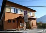
Maison du Parc de l'Embrunais
Place de l’Église, 05380 Châteauroux-les-Alpes
Information, documentation, exhibition, screenings, products and books of the Park. Accessible to people with reduced mobility. Free admission. All animations of the Park are free unless otherwise stated.
Transport
Public transport: www.pacamobilite.fr
Consider car-sharing: www.blablacar.fr
Access and parking
Parking :
Accessibility
More information
Source

Report a problem or an error
If you have found an error on this page or if you have noticed any problems during your hike, please report them to us here:
