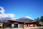
Col du Morgonnet and Cabane du Jas
This loop alone offers numerous emblematic features of the Hautes-Alpes: old agricultural sites, a panoramic view over the whole of the Lac Serre-Ponçon, a number of wild animals and a unique larch specimen. Its mix of features is what makes this trail so rich.
6 points of interest
 Fauna
FaunaZygaena hilaris
This is a medium-sized butterfly (25-35 mm wingspan), often brightly coloured, with up to six spots on the inner wing. This Burnet is found on the edges of limestone meadows, steppe-like slopes, dry shrublands and clearings in dry forests. This remarkable species is indicative of the quality of the habitats. It is not nevertheless endangered, which is why it is not on the list of threatened species. Vernacular heritage
Clapiers
"Clapier" is the term used in the Southern Alps to describe a pile of stones. They are evidence of former farming activities. The stones were once removed to clear the fields. This made it easier to work the soil and saved space. Back then, everything was done by hand. Flora
FloraFeather grass
Feather grass is a perennial plant in the family Poaceae. This plant is found on dry to very dry stony ground, preferring a limey soil. Its seeds are scattered by the wind, aided by their long silky plumes. It is easy to mis-identify feather grass: look out for the hairless tips on young leaves of the sterile sprouts, and the yellowish base of the awn when mature. Panorama
Panorama from the Col du Morgonnet
Take to the heights to enjoy this extraordinary 360°C view. This perspective will delight young and old alike, what with the imposing Morgon to the north, the Ubaye valley to the east, the La Blanche mountain range and Haute-Provence to the south and, finally, Serre-Ponçon with its dam and the Durance valley stretching away to the west.
 Vernacular heritage
Cabane du Jas
In Provencal, jas means gîte. This term is used to describe the large traditional sheepbarns built far away from the farms and hamlets, near to the grazing areas. Generally of dry stone construction, these heritage features bear witness to a pastoral lifestyle which can be difficult to imagine now, because vegetation has taken over and the location seems so isolated and difficult to reach. Flora
FloraThe Larch
The king of trees in the mountains of the Southern Alps, the Larch is the only conifer to lose its needles in winter. In spring, its cones are a characteristic dark purple. The larch is one of the rare European species that is rot-proof, i.e. it does not rot. That’s why, despite the fact that it twists when dried, it is often used for roofing, drinking troughs and other gutters in mountain villages. Unable to regenerate under its own undergrowth, it needs natural openings such as avalanches if young shoots are to develop. It can be found at altitudes of over 2,200 metres, adopting dwarf forms in these combat zones. The larch seen at this point in the walk is several hundred years old.
Description
- From the car park, turn right and follow the track .
- At the next intersection, carry straight on and stay on the left-hand track through the forest of larch, black pine and Scots pine.
- At the picnic table, turn left and take the narrow path leading up through the forest. Stay on the left-hand path until you reach the summit: panoramic view of the territory of Serre-Ponçon. Follow the ridge and take the path on the left which brings you back to the picnic table. From here, take the north-facing ("Ubac") path, turning left, until you come to the Cabane du Jas, where freshness and shade await you. After a stop, continue straight ahead.
- Follow the ridge down until you reach the pass. Turn left just before the Crête de la Coquille (which can be reached with an extra 20 minutes' walk) which brings you back to the car park.
- Departure : Above "Les Hugues", Pontis
- Arrival : Above "Les Hugues", Pontis
- Towns crossed : Pontis
Altimetric profile
Recommandations
Plan ahead and take sufficient water as there are no water points along the route.
Information desks
Tourist office Savines-le-Lac
9 Avenue de la Combe d'Or, 05160 Savines-le-Lac
October to march : Monday to Saturday, 9.00 - 12.30 & 13.30 - 17.00.
April, may, june & september : Monday to Saturday, 9.00 - 12.30 & 14.30 - 18.00
July and August : Monday to Saturday, 9.00 - 13.00 & 15.00 - 19.00. Sundays, 10.00 - 13.00 & 15.00 - 18.00
Closed on French national holidays, except 14th of July, and 15th of August
Closed on Thursdays outside French holidays’ periods
Transport
Public transport: www.pacamobilite.fr
Consider car-sharing: www.blablacar.fr
Access and parking
From Pontis, take the D7 until you reach the Col de Pontis. At the roadmender's hut ("Cabane du Cantonnier "), turn left and follow the main track. At the next fork, follow the upper route. At the crossroads, go left before « les Hugues » and carry on until you come to the car park.
Parking :
Accessibility
More information
Source

Report a problem or an error
If you have found an error on this page or if you have noticed any problems during your hike, please report them to us here:
