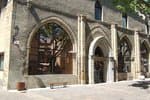
The balconies of Embrun
2 points of interest
 History
Footbridge over the Durance
This footbridge, which was completed in 2019, links Embrun with Crots and Baratier. Although it is a recent development, it actually boasts a long history. It stands on the exact site of the temporary bridge that replaced the La Clapière road bridge from 1953 onwards, which was destroyed during the Second World War by resistance fighters from the Embrunais area after the failure of an American bombing to do so. The aim was to prevent German forces from sending reinforcements to Gap, whose liberation was imminent. Although the bridge managed to withstand the American bombs, several people were killed and an explanatory panel on the footbridge pays tribute to them today.
. Vernacular heritage
Church of Saint-Chaffrey
This building dates back to the fifteenth century. It has the same architectural style as the Abbey of Boscodon. Like many churches in the area, it has been ransacked on a number of occasions and was set alight by the Army of Savoie. The church was completely restored in 1998. In the sundial, there is a saying: "Poor but proud, and in good heart". Next to it is the village's coat of arms, which is represented by a greyhound.
Description
- From Embrun station, turn right and go over the railway line. Take the "Route de Caléyère", which rises very quickly. The climb lasts almost 5 km, before reaching the Château de Caléyère. Shortly afterwards, you can enjoy a moment's rest and a beautiful view of Lake Serre-Ponçon, the surrounding peaks and the various valleys.
- Continue on a small road then descend towards Embrun, after passing through the hamlets of Les Barthelons and Les Maures as well as other residential areas. Follow the railway line, cross it at the level crossing, then turn right. Continue for 600m before turning left and leaving the D994h. Stay on this road until you take a left fork, then immediately right to join the route de la digue.
- Go along the river veering right, with views over the citadel of Embrun. When you reach a footbridge, cross over the Durance. Follow the cycle path towards Baratier (short section under the N94) and head towards a roundabout. Take the third exit towards Les Orres (D40) and climb for 8 km before reaching an intersection.
- From here, take the tarmac lane that heads off to the right towards Le Pont (D540). Join the Mélézet and then a much wider departmental road (D40).
- Stay on this road going left, past a hairpin bend then downhill for 5 km.
- Slightly after the hamlet of Rabast (sign near a bus stop), at the start of a curve, keep your eyes peeled for a right turn towards Les Gaillards. Then head to the church of Saint-Sauveur for a short stop to admire the breathtaking panorama.
- Continue towards Crévoux for 4 km and join the D39 at a hairpin bend.
- Then head towards Saint-André-d'Embrun and, 1 km before the village (on the D139), choose the small route that climbs to the right towards Les Lagiers. Continue for 2 km until you come to a hairpin bend, then turn left onto the D994d. Follow the signs for Embrun for 4 km and turn right at the STOP sign. Cross the Durance on a metal bridge (wooden floor) towards the citadel of Embrun.
- Finally, take the last ascent back to the starting point.
- Departure : Station car park, Embrun
- Arrival : Station car park, Embrun
- Towns crossed : Embrun, Baratier, Saint-Sauveur, Les Orres, and Saint-André-d'Embrun
Altimetric profile
Information desks
Tourist office Embrun
Place Général Dosse - BP 49, 05202 Embrun
October to march : Monday to Saturday, 9.00 - 12.30 & 13.30 - 17.00.
April, may, june & september : Monday to Saturday, 9.00 - 12.30 & 14.30 - 18.00
July and August : Monday to Saturday, 9.00 - 19.00. Sundays, 10.00 - 12.30 & 16.00 - 19.00
On French national holidays (except 14th of July and 15th of August) : 9am to 1pm. Closed on the 1st of January, 1st of May, 25th December and 11th November
Closed on Thursdays outside French holidays’ periods
Transport
- Zou! network : Line 69 / Frequency : 5 times a day
- Zou! network : Line 69 / Frequency : Every 4 hours
- SNCF bus
Access and parking
Parking :
More information
Source

Report a problem or an error
If you have found an error on this page or if you have noticed any problems during your hike, please report them to us here:
